Blue Devil 2.0

Teachnology for K-5 Teachers

Wonderful Websites

November19

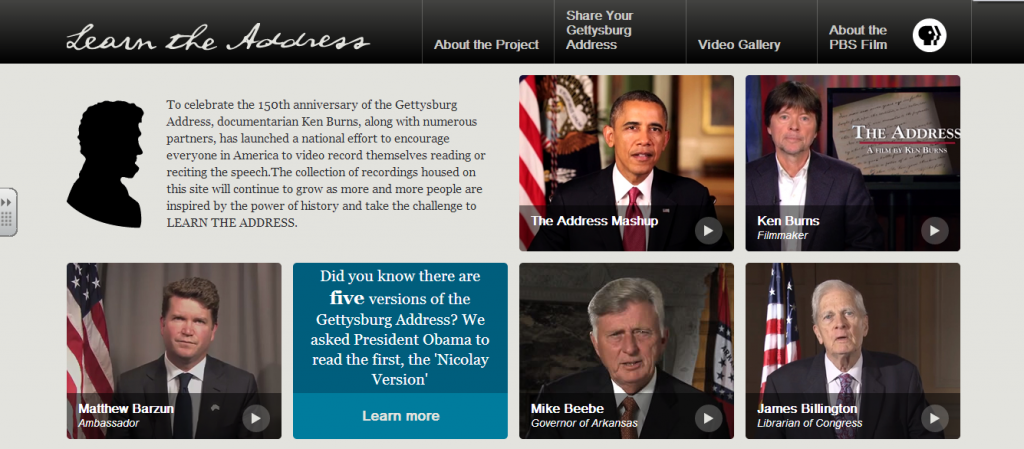
Home - Learn the Address
Today is the 150th anniversary of the Gettysburg Address. To celebrate the anniversary, documentarian Ken Burns, along with numerous partners, has launched a national effort to encourage everyone in America to video record themselves reading or reciting the speech.The collection of recordings housed on this site will continue to grow as more and more people are inspired by the power of history and take the challenge to LEARN THE ADDRESS.

Here is another  great site to help use primary sources and technology in your classroom. The U.S. National Archives Experience Digital Vaults  offers your class a good introduction to discovering and working with primary source materials. Digital Vaults focuses on a curated collection of 1,200 items. On the site, there are activities designed to help students discover important connections between primary sources. One activity  Pathways Challenges, provides quizzes that ask students to analyze a specific resource and then find the related document within the collection. You can also use the resources to create your own quizzes and students can use the resources for projects. Click below for Revolution sources:

If you would like to learn more about using primary sources, contact me.

Happy tech trails Blue Devils!


Print Friendly, PDF & Email

Free App of the Day

June24

History-Maps of World for iPhone 3GS, iPhone 4, iPhone 4S, iPhone 5, iPod touch (3rd generation), iPod touch (4th generation), iPod touch (5th generation) and iPad on the iTunes App Store


History: Maps of the World

From iTunes:

★ HISTORY:MAPS SERIES CAME BACK COMPLETELY NEW!!! ★

“Explore the world through interactive maps illustrating geopolitical and geographic shifts over time. Users peruse the various cartographies and read up on the historical (or, as the case may be, scientific) significance of each major change through text and ”in the future” other media.” – Edudemic, The 16 Apps And Tools Worth Trying This Year

“History and geography (duh) collide on this very popular resource, which provides access to maps past and present so users can watch how borders and projections shift over time.” – Edudemic, 50 Must-Download Apps For Lifelong Learners

“History:Maps of the world should be used by every history teacher. This just has so much information on it, and could help elementary all the way up to college students. If I was a history teacher, I would definitely love to have this, because it saves me the time to find all the maps needed for he curriculum.” – ArjanL774’s App Reviews

“History:Maps of World” is the best way to see and learn historical geography.

If you are interested in history and geography (history teacher, student or amateur history researcher), check it out to keep with your history and learn something about history.

• Provide 178 historical maps around the world
• Grouping by category or era
• Keyword search
• Display the source about each map

Print Friendly, PDF & Email

Webinar Wednesday

May29

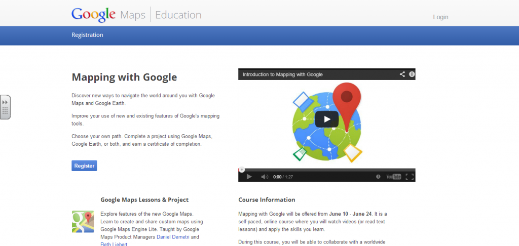
Mapping with Google - Course

For those of you who are looking forward to next year, Google offers a free two-week professional development class on Google Maps and Google Earth.  You will learn how too use these tools to enhance your lessons in a variety of subject areas.  Please see the description from Google below and click on the image above if you are interested in registering.  The course is self-paced and can be done on your own schedule.  I am planning on taking the course so please let me know if you have any questions or need any assistance.

Happy teach trails Blue Devils!

From Google:

“From your own backyard all the way to Mount Everest, Google Maps and Google Earth are here to help you explore the world. You can learn to harness the world’s most comprehensive and accurate mapping tools by registering for Mapping with Google.

Mapping with Google is a self-paced, online course developed to help you better navigate the world around you by improving your use of the new Google Maps, Maps Engine Lite, and Google Earth. All registrants will receive an invitation to preview the new Google Maps.


Through a combination of video and text lessons, activities, and projects, you’ll learn to do much more than look up directions or find your house from outer space. Tell a story of your favorite locations with rich 3D imagery, or plot sights to see on your upcoming trip and share with your travel buddies. During the course, you’ll have the opportunity to learn from Google experts and collaborate with a worldwide community of participants, via Google+ Hangouts and a course forum.


Mapping with Google will be offered from June 10 – June 24, and you can choose whether to explore the features of Google Maps, Google Earth, or both. In addition, you’ll have the option to complete a project, applying the skills you’ve learned to earn a certificate. Visit g.co/mappingcourse to learn more and register today.


The world is a big place, we like to think that you can make it a bit more manageable and adventurous with Google’s mapping tools.”
Print Friendly, PDF & Email

Wonderful Website

May21

5-21-2013 9-46-59 AM

National Geographic Kids

This website provides many resources to help your students learn science, geography and history.  The site has video clips on nature, history, animals, the environment, and space.  The animals section contains links to profiles that your students can use for research.  There are country facts and images and a news section that provides articles on a student level.  The site is engaging and interactive  Students will find it easy to use and could be helpful for end of the year projects.

Happy tech trails Blue Devils!

Print Friendly, PDF & Email

Free App of the Day

May20

5-20-2013 10-08-48 AM


Mission US: Think Fast! About the Past

From iTunes:

Test your knowledge of history as you race against the clock! Featuring characters from the online role-playing adventure game Mission US, Think Fast! About the Past is a fast-paced trivia game that introduces hundreds of fascinating facts about different eras of American history.

Players can choose from two different Think Fast “missions,” each connected to one of the Mission US adventure games. In Mission 1, the sharp-tongued Patriot Royce Dillingham challenges players to navigate 1770 Boston by answering questions about colonial history. In Mission 2, Lucy King challenges players to deliver a message to her brother, who is enslaved on a plantation in 1850 Kentucky, by answering questions about slavery and resistance during the pre-Civil War era.

Each correct answer advances players to another location on the map. Players have five minutes to move through all ten locations to complete the challenge, but answering correctly more quickly will earn a higher ranking. The clock pauses whenever explanations appear to allow players time to read them. Each “mission” includes approximately 100+ questions randomly served up during the course of the game.

The Think Fast! About the Past app, developed by Thirteen/WNET, the producers of Mission US, and Very Memorable, was funded by the National Endowment for the Humanities and the Verizon Foundation through EDSITEment, the NEH site for high quality teaching resources. Mission US, a series of free interactive US history games for tweens and teens, was funded by the Corporation for Public Broadcasting with additional support from the National Endowment for the Humanities. For more Mission US content, visit mission-us.org. (Any views, findings, conclusions, or recommendations expressed in this app do not necessarily represent those of the National Endowment for the Humanities.)

Print Friendly, PDF & Email

Terrific Teacher Tuesday

May14

Two weeks ago, I featured Mrs. Reichel and Mrs. Twari who led a virtual chat with an American family in China.  Now the video of that chat is available for you to use in your classroom.  The video is in two parts which are fifteen minutes each.  I hope they help your students with their studies of China.

Part 1- School, sports, Chinese New Year, fishing, Beijing, transportation, pets, emperors, life, The Great Wall

Part 2- Food, weather, pandas, tigers, homes, clothing, funny stories, language

Print Friendly, PDF & Email

Terrific Teacher Thursday

May2

This Thursday we feature a few teachers who have used technology bring the countries they are studying right into their classrooms.  In kindergarten, Joellen Surace and her students have been learning all about England.  They have spent many weeks learning about the customs, history, and culture of our neighbors across the pond.  Joellen was fortunate to have one student who’s uncle lives in London with his family.  Joellen decided that it would be a great learning experience to Facetime with them and learn what life was like in England.  We set up an iPad and connected it to her T.V..  Students were then able to talk to a second grader about what life was like for her compared to life in Westfield.  The students learned many things and were so excited to talk to to a new friend from far way!

The Set Up:

Friends from England

In Karen Reichel’s second grade class, they have been learning all about China. Monika Tiwari, her student teacher, has a friend who is currently living in Bejing with her family. This class prepared questions to ask about all aspects of life in  China. They were taught by the Brewer family about food, transportation, school, games, and so much more.  The students loved learning from the family and even got to learn some of the Chinese language and martial arts moves.

Take a look:

Happy international tech trails Blue Devils!

Print Friendly, PDF & Email

Wonderful Websites

May1

I know that many of you second grade teachers are currently working on your unit on China.  This website contains links to interactive sites on many China and Asia topics.  You can use them with your interactive whiteboards or on individual websites.

Happy tech trails Blue Devils!

Print Friendly, PDF & Email

Wonderful Websites

April22

I know that many of you fifth grade teachers are beginning your studies of the American Revolution.  Back in the fall we met and talked about using primary sources in your lessons.  I have found another resource that can help you to do this. The U.S. National Archives Experience Digital Vaults  offers your class a good introduction to discovering and working with primary source materials. Digital Vaults focuses on a curated collection of 1,200 items. On the site, there are activities designed to help students discover important connections between primary sources. One activity  Pathways Challenges, provides quizzes that ask students to analyze a specific resource and then find the related document within the collection. You can also use the resources to create your own quizzes and students can use the resources for projects. Click below for Revolution sources:

Happy tech trails Blue Devils!


Print Friendly, PDF & Email

New Apps for the iPad Carts Part 2

April2

From iTunes:

If you can imagine it, you can build it with TinkerBox.

TinkerBox is a fun, free-to-play physics puzzle game. While it is full of interesting science facts and teaches basic engineering concepts, TinkerBox is more than just educational!

Take the tools in your hands to explore your creativity and imagination with Invent mode. Build outrageous machines, share them with your friends, or download popular inventions online at http://www.tinkerboxnews.com.

Stretch your brain through the devious Puzzle mode. Get immersed in physics-based puzzles and mechanical concepts, where your only hope for success is your creative problem solving.

Dream. Build. Share. TinkerBox.

From iTunes:

Always at the forefront of innovation, the University of Waterloo initiated a collaborative student-design project to celebrate 2011 as the International Year of Chemistry. Chem 13 News together with the Chemistry Department and the Faculty of Science encouraged chemistry educators and enthusiasts worldwide to adopt an element and artistically interpret that element to eventually be brought together in a mosaic of science and art. A year later, with the project complete, we have designs by chemistry students from all Canadian provinces and territories, 20 US states and 14 different countries. Each element captures a unique and creative spark but together they ignite a passion for chemistry.

From iTunes:

Evernote is an easy-to-use, free app that helps you remember everything across all of the devices you use. Stay organized, save your ideas and improve productivity. Evernote lets you take notes, capture photos, create to-do lists, record voice reminders–and makes these notes completely searchable, whether you are at home, at work, or on the go.

✧ New York Times ‘Top 10 Must-Have App’, Winner: TechCrunch Crunchies, Mashable Awards and the Webbys. ✧

Key Features:
• Sync all of your notes across the computers and devices you use
• Create and edit text notes, to-dos and task lists
• Save, sync and share files
• Record voice and audio notes
• Search for text inside images
• Organize notes by notebooks and tags
• Email notes and save tweets to your Evernote account
• Connect Evernote to other apps and products you use
• Share notes with friends and colleagues via Facebook and Twitter
• Works with Evernote Business: Capture, browse, search, and share Business Notes and Business Notebooks from your iPhone, iPad and iPod Touch.
◦ Premium feature: take notebooks offline to access them anytime
◦ Premium feature: allow others to edit your notebooks
◦ Premium feature: add a PIN lock to your Evernote app

From iTunes:

Hold the world in the palm of your hand. With Google Earth for iPhone, iPad, and iPod touch, you can fly to far corners of the planet with just the swipe of a finger. Explore the same global satellite and aerial imagery available in the desktop version of Google Earth, including high-resolution imagery for over half of the world’s population and a third of the world’s land mass.
With Google Earth, you can:
• Navigate the world with a swipe of your finger
• Swipe with two fingers to adjust your view to see mountainous terrain
• Show the Panoramio layer and browse the millions of geo-located photos from around the world
• View geo-located Wikipedia articles
• Use the Location feature to fly to your current location
• Search for cities, places, and business around the globe with Google Local Search

From iTunes:

Preview award-winning Inspiration Maps with Inspiration Maps Lite

Work with up to five diagrams to create maps, edit and stylize content, transform diagrams to outlines, and preview templates. —> For unlimited diagrams that you can export to Inspiration 9.1, use with other apps, and share with others: upgrade to Inspiration Maps, the visual thinking and learning application for the iPad. Students build their knowledge by creating diagrams, maps and organizers that help them brainstorm, plan, organize and build thinking skills. Tap to transform visual work into outlines that export for writing. Use Inspiration Maps to:

– Brainstorm new ideas and capture insights
– Analyze information
– Understand cause and effect
– Organize projects
– Organize thoughts and topics for writing
– Take notes
– Study for exams

Features:
– Friendly design developed specifically for iPad
– Diagrams are easy to build – and save instantly
– Create an unlimited number of documents*
– Diagrams transform to outlines with a tap
– Personalize with images, color, shape, arrow style, and backgrounds
– Use images from the web or the iPad camera
– Attach notes to any item to start writing
– Add hyperlinks
– Dozens of templates are included
– Optimized for the Retina display
– Additional templates available in Spanish and UK English
– Localized in Spanish and UK English
 

Print Friendly, PDF & Email
« Older Entries

Skip to toolbar